Sea Level Rise Adaptation Planning
If you would like to receive updates on Sea Level Rise adaptation planning in Emeryville, subscribe at the link below. If you already receive City notifications, sign-in and choose "Add Subscriptions" (located at the bottom of the page you will be taken to after sign-in) to add new topics to your list.
Notify Me!
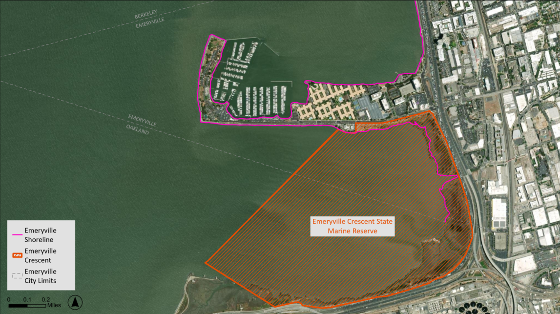
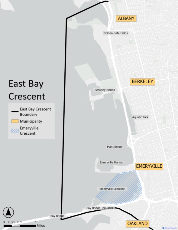
In 2025, City of Emeryville began sea level rise adaptation planning in partnership with the San Francisco Estuary Partnership (SFEP), land use agencies, resources agencies, and cities with jurisdiction anywhere along the shoreline between the Bay Bridge Toll Plaza and the Contra Costa County border. This section of the shoreline is called the East Bay Crescent and includes the entire Emeryville shoreline. The East Bay Crescent includes the Emeryville Crescent, a special section of wildlife habitat along Emeryville's shoreline.
East Bay Crescent Crescent Shoreline Planning and Adaptation
What is Sea Level Rise?
Sea level rise is defined, according to the National Oceanic and Atmospheric Organization (NOAA), as the permanent average increase in ocean water levels worldwide. The event is, in part, caused by the melting of land-based ice, such as glaciers and ice sheets, due to rising temperatures experienced worldwide.
Regional Sea Level Rise Adaptation Planning
In accordance with California Senate Bill 272, The San Francisco Bay Conservation and Development Commission (BCDC) requires local governments to complete a Subregional Shoreline Adaptation Plan, part of the RSAP, by January 1st, 2034. Explore the links below to learn more.
Adaptation Funding
SFEP is leading all partners in applying for California Ocean Protection Council SB 1 funding to conduct a shoreline vulnerability assessment and ultimately develop the required Subregional Shoreline Adaptation Plan. To learn more about the Subregional Shoreline Adaptation Plan and the Regional Shoreline Adaptation Plan (RSAP), see "Regional Sea Level Rise Adaptation Planning" below. To learn more about Ocean Protection Council SB 1 funding, check out the link below.
Emeryville Crescent Community Visioning Process
Emeryville Crescent Community Visioning Process
San Francisco Bay Living Shorelines Project
Explore the links below to learn more.
Maps
Emeryville Crescent Map
East Bay Crescent Map
Contact Us
For any questions related to Sea Level Rise, please contact zerowaste@emeryville.org.